Townwalk Willemstad
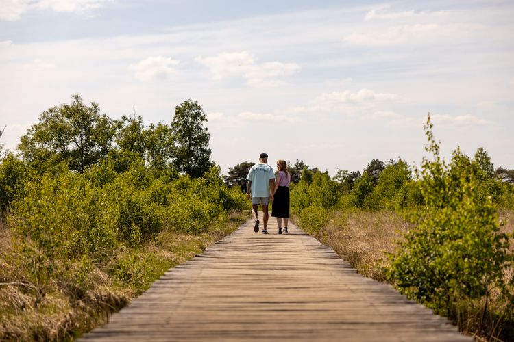
Willemstad is one of the eleven fortified towns along the Zuiderwaterlinie. Follow the junctions on an 8.0 kilometre walk and experience the special historical atmosphere of this town.

Show all 5 photos

Discovering the Willemstad defences
Willemstad is one of the eleven fortified towns along the Zuiderwaterlinie. Follow the junctions on an 8.0 kilometre walk and experience the special historical atmosphere of this town.
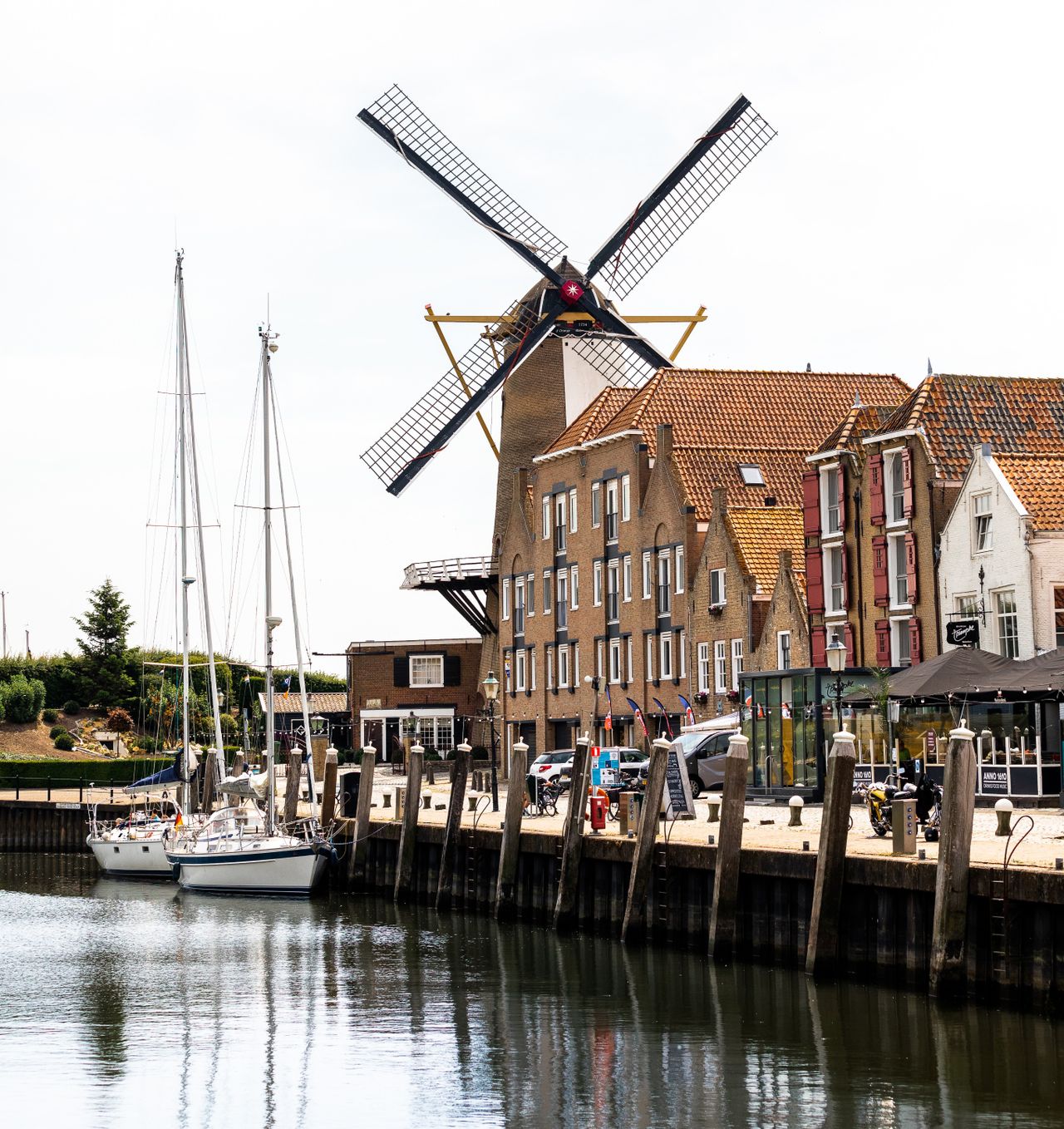
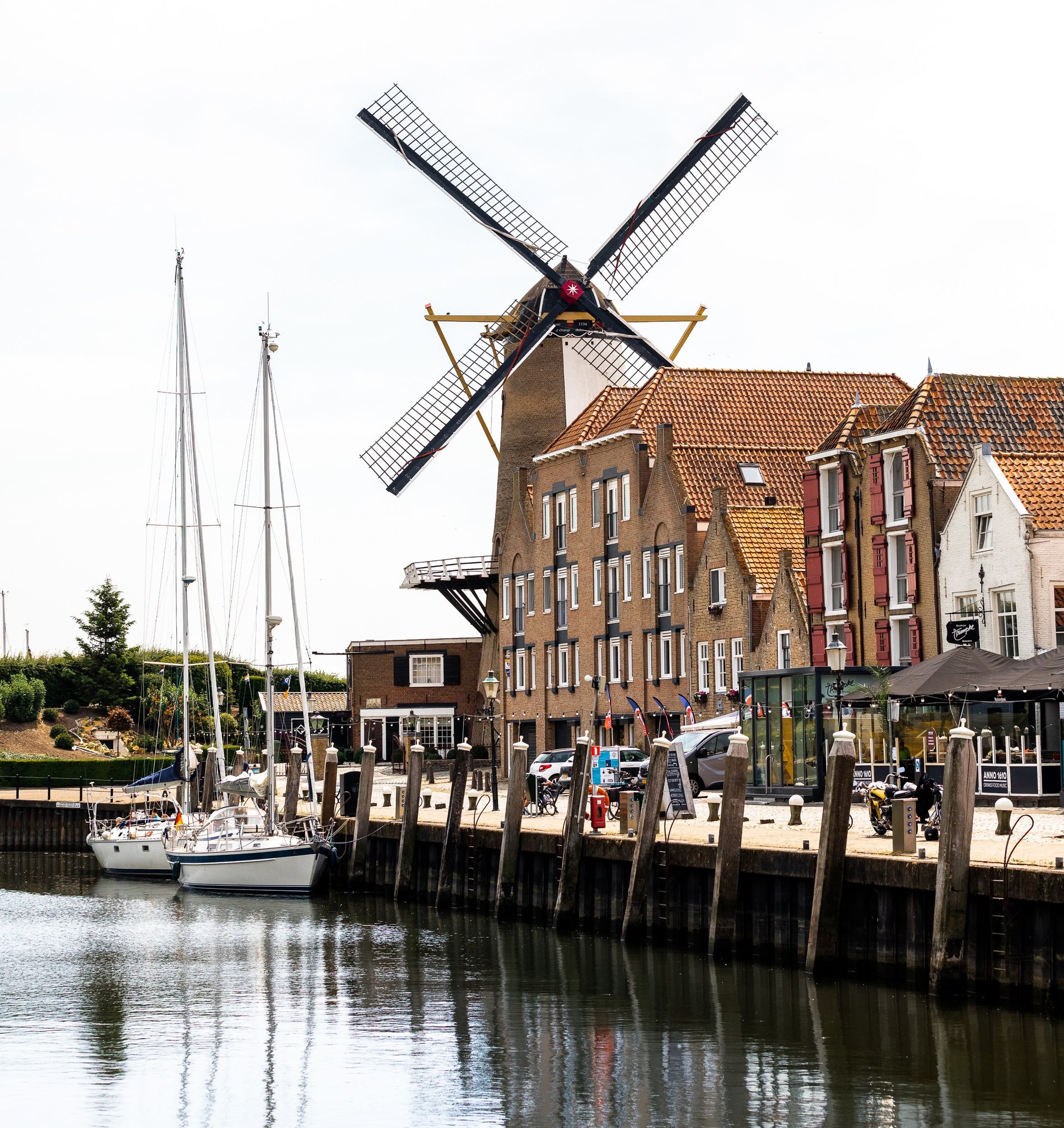
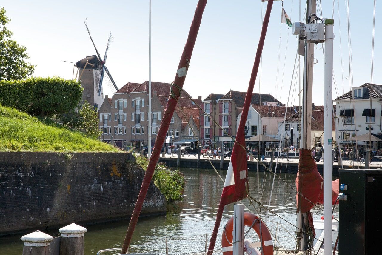
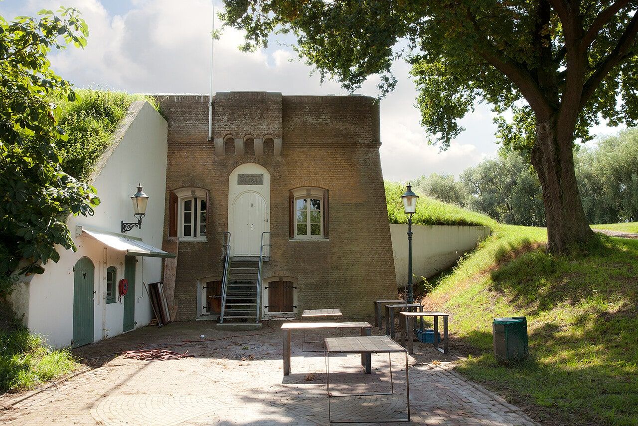
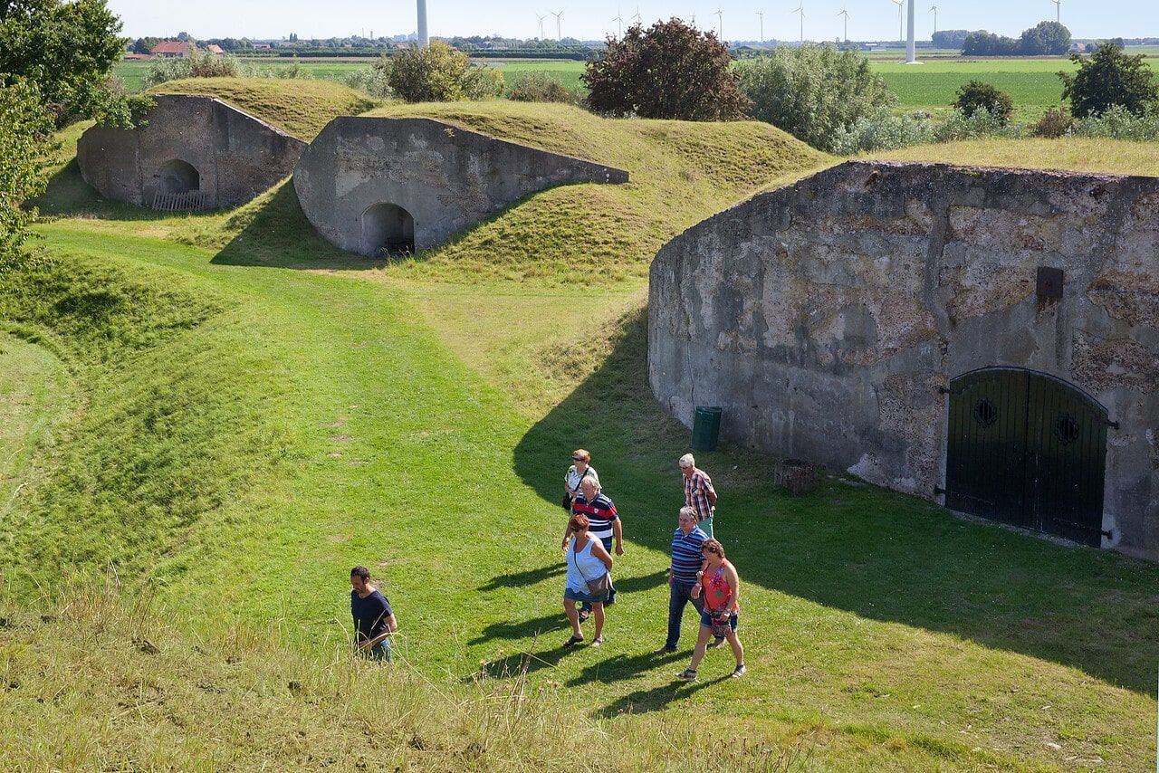
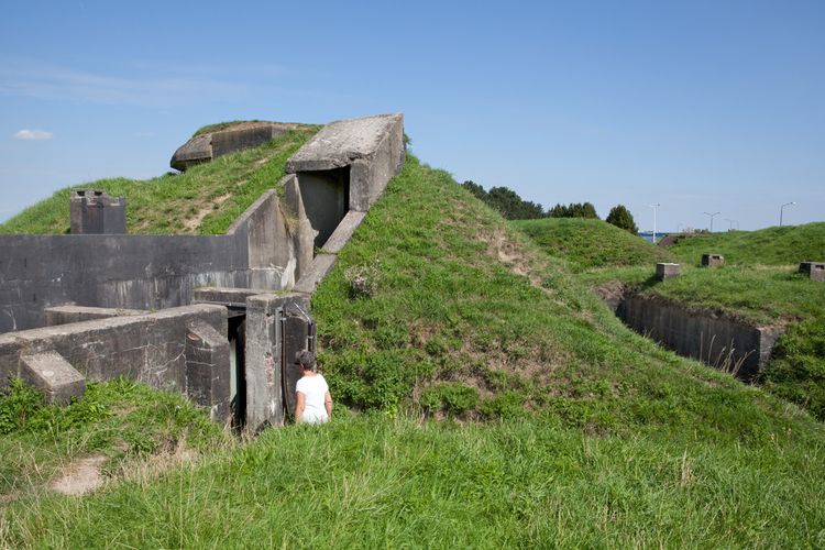
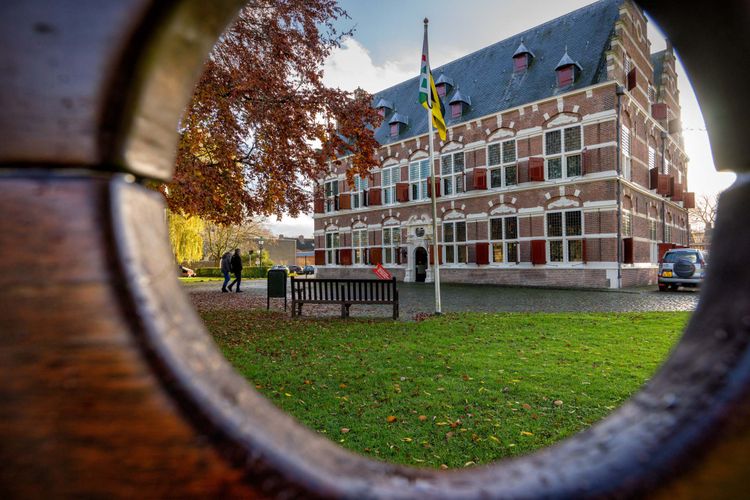
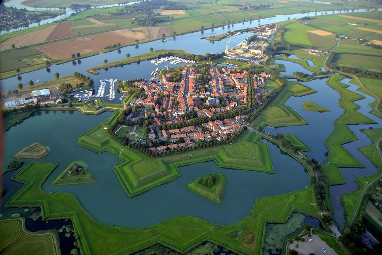
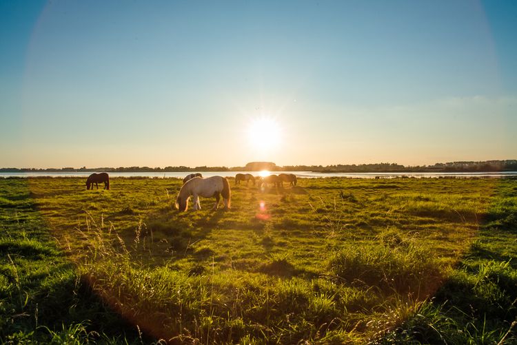
Willemstad has the shape of a seven-pointed star and is surrounded by five fortresses, of which Fortress Sabina is the most impressive. Through the centuries, the strategically located Defence Line of Willemstad was an excellent place to control shipping between Holland, Zeeland and Antwerp. The bastions and ramparts are still largely intact. You will be walking along the Volkerak and the beautiful Zwanenmeer (swan lake), after which you will enter the fortress via the Noordlangeweg road on the other side of Willemstad.
The town is one big monument. For example, there is th…
Discovering the Willemstad defences
Willemstad is one of the eleven fortified towns along the Zuiderwaterlinie. Follow the junctions on an 8.0 kilometre walk and experience the special historical atmosphere of this town.
Willemstad has the shape of a seven-pointed star and is surrounded by five fortresses, of which Fortress Sabina is the most impressive. Through the centuries, the strategically located Defence Line of Willemstad was an excellent place to control shipping between Holland, Zeeland and Antwerp. The bastions and ramparts are still largely intact. You will be walking along the Volkerak and the beautiful Zwanenmeer (swan lake), after which you will enter the fortress via the Noordlangeweg road on the other side of Willemstad.
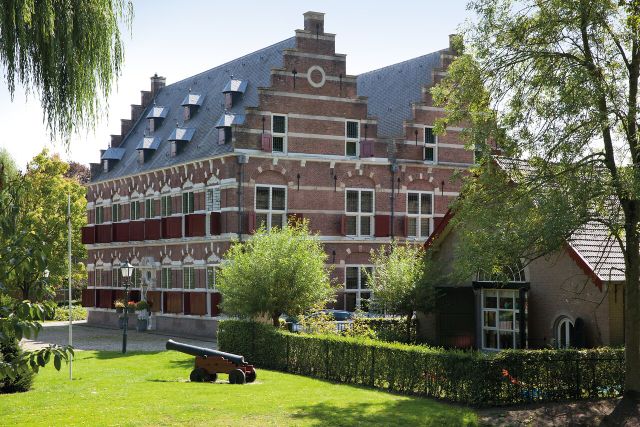
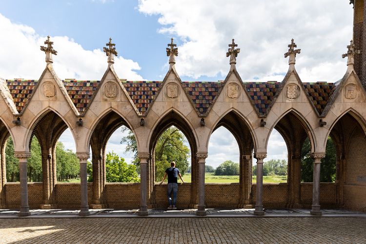
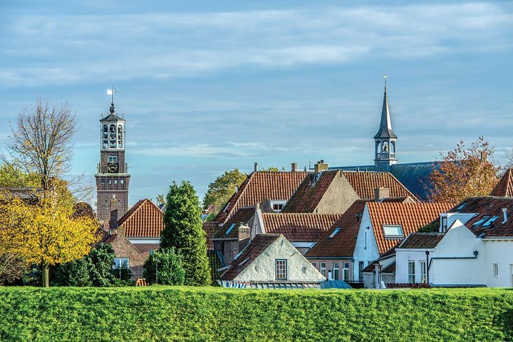
The town is one big monument. For example, there is the monumental Mauritshuis mansion, the former country residence of Prince Maurits of Orange from 1623. The walk takes you past the churches Heilige Maagd Maria kerk and Koepelkerk. Relax in one of the charming cafés and restaurants on the lively marina. Finally you will stroll outside the walls over the canal, which will give you a different view of the ramparts. Relax in one of the charming cafés and restaurants on the lively marina.
Walk along the Zuiderwaterlinie in Brabant
Discover the Zuiderwaterlinie (southern water line), the oldest, longest and most used waterline in the Netherlands. A unique chain of 11 fortified towns, forts and ramparts in Brabant, connected by the typical Dutch tradition of using water for defence.
Inheritance of an eventful past
For centuries the Zuiderwaterlinie served to protect the country against attacks. The waterline runs all the way from Bergen op Zoom in the south-west to Grave in the north-east of Brabant. Everywhere along the line you’ll find traces of an eventful past. Beautiful city monuments that are reminders of the time when soldiers still stood in front of the gates. Many of these monuments can be visited. Beyond the fortified towns you will find sturdy forts, ramparts, lunettes and redoubts. Provision rooms have made way for lively cafés and restaurants.
Zuiderwaterlinie footpath
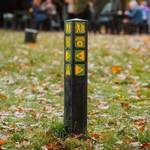
The Zuiderwaterlinie footpath is a 290-kilometre walk and is marked out via the Brabant junction system, allowing you to walk from one junction to the next.

-
Hotline routes
Hotline routesIf there is something wrong on the route, report it here.
Tips from Brabant residents
Skip map elementsLocations on this route
Start point:
Waypoint walk 52
Willemstad
Navigate to starting point
Visitor Centre Mauritshuis
Welcome to the Mauritshuis! Start in the Canon Room, play the Fortress game or experience the Siege of the French in the Governor's Room. Three themes, divided over several rooms, will let you experience the stories of the Stelling of Willemstad and more!
End point:
Waypoint walk 52
Willemstad
Navigate to endpoint
Story of the route
Start point:
Waypoint walk 52
Willemstad
Navigate to starting point
- Mauritshuis mansion
Begin your journey of discovery in the Canon Room of the Mauritshuis mansion. Press the red button and bring the room to life! From the defences against the Spaniards to the conquest of the Germans. In this special room, young and old can experience the entire military history of this historical site with its fortifications and strongholds. After the Canon Room, visit the local history museum on the top floor of the Mauritshuis. - Fortress Sabina
Special features of this fort are the Tour Modèle from Napoleon’s time, underground corridors and the large barracks that can now be used as a meeting location. Be inspired by Sabina: the largest and one of the most intact Brabant forts. Climb up the fort, see the casemates and find your way in! Fort Sabina is now also accessible by ferry ‘De Waterpoort’. For more information and sailing times visit www.waterpoort-rondvaarten.nl. - Waterbus
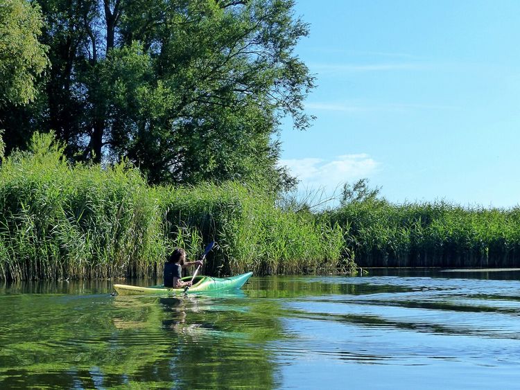
Discover the Haringvliet river with a Waterbus! A lovely sailing route through beautiful countryside. The Waterbus calls at various destinations on the Haringvliet: Hellevoetsluis, Stellendam, Middelharnis, Willemstad and the natural island of Tiengemeten. During the summer months the Waterbus sails to Willemstad from Rotterdam, Dordrecht and nature reserve Tiengemeten every Wednesday, Thursday and Sunday. For the exact timetable, sailing days and mooring locations, please visit www.waterbus.nl. Order your tickets online.
End point:
Waypoint walk 52
Willemstad
Navigate to endpoint
- 52
- 55
- 87
- 88
- 89
- 50
- 51
- 50
- 89
- 88
- 52
-
Tips for a sustainable weekend away or day out in North Brabant
Does travelling actually fit within a sustainable lifestyle? Yes, it does! Often, small adjustments can make a huge difference.
-
A cultural city trip: Breda and surrounding area
Breda is a city filled with unique stories, some of which you will learn about during this two-day trip.
-
From monastery gardens to drifting sand dunes: a 5-day motorhome road trip through the Van Gogh National Park
Hike and cycle through Van Gogh National Park on a 5-day east–west route. Discover nature, local flavours, and stories, with welcoming motorhome stops near monasteries, castles, woods, dunes, and lively Brabant towns.
-
Reflection and wonder on a two-day walking trail
For centuries, Brabant’s countryside has inspired monks and Van Gogh. Follow their footsteps on a 2-day walk past monasteries, abbeys, and the Oisterwijk Forests & Fens, with a night in the peaceful countryside.
-
A weekend for slowing down in North Brabant
Two days of wandering through monasteries, castles, forts and fortified cities with plenty of time along the way for culinary enjoyment at creative food hotspots – this is possible in North Brabant.
-
A long weekend of surprises in the heart of Brabant
Allow yourself three days to be amazed by a part of North Brabant between Tilburg and Esbeek, close to the Belgian border.
-
5 times UNESCO in North Brabant
UNESCO is best known for the World Heritage List. But UNESCO also recognises heritage in other areas, which means you will encounter UNESCO sites also in North Brabant.
-
Slow travel along the best parts of the Land van de Peel
A region where the heart beats to the unmistakable Brabant hospitality, individuality, and passion for enjoying life in a way that only the people of Brabant know how to do.
-
6 places in North Brabant to go winter camping: A unique adventure
Winter camping is an exciting and unique experience. Nature has gone into a deep sleep and, at the campsite itself, you can enjoy the silence around you.
-
A weekend in the wilderness of De Biesbosch National Park
Would you like to wake up to a nature reserve in your front yard? Or go on a city trip with a city campsite as your homebase? A holiday or weekend away with your motorhome is never a problem in North Brabant.